Penticton is situated in British Columbia, Canada's most westerly province. It is Canada's third largest province, occupying almost ten percent of its land surface.
BC is nearly four times the size of Great
Britain, 2.5 times larger than Japan, and larger than all the U.S.
States except Alaska.
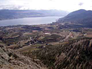
Penticton is located in BC's south centre region, collectively known as
the Okanagan Valley or simply the Okanagan. It is renowned the world
over as one of the most pleasant areas in Canada in which to live or
visit. The Okanagan Valley is the northern extension of the Columbia
River basin, and forms a high temperate desert area.
From the Town of Osoyoos at the United States border to Salmon Arm at the northern extreme, the Okanagan Valley stretches over 200 km, yet averages only 10 km wide for most of that distance.
Penticton is located at latitude 49 degrees, 28'; longitude 119 degrees, 36'. The city's area is 4,447 hectares (about 17.5 square miles). The elevation at the Penticton Regional Airport is 344.4 meters (1,130 ft.) above sea level.
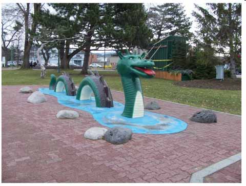
Okanagan Lake is one of British Columbia's best known and largest warm water lakes. The lake is over 120 km long and connects the three major urban centres of Vernon, Kelowna and Penticton. Okanagan Lake has also gained an international reputation as the home of the famous lake monster “Ogopogo“. Skaha Lake located at Penticton's south end is over 24 km long and also offers warm waters to enjoy. Many relax by floating down the 6 km long river channel that connects Okanagan Lake to Skaha Lake.
Penticton has convenient access to major Provincial transportation corridors running north and south, east and west. It is located at the junction of the major north-south highway (#97) and the main east-west highway (3A) sometimes referred to as British Columbia's most important southern-interior crossroads. Situated just 380 km (242 miles) from Vancouver and 670 km (416 miles) from Calgary. Penticton is well connected to the BC and Trans-Canada Highway system. The Coquihalla Highway and Okanagan Connector (Highway 97C), is a four-lane divided freeway which puts Vancouver and the West Coast within only a half day's drive.
Highway 97 runs from the Yukon and Alaska through the centre of British Columbia to Washington, Oregon and California. The segment of highway that runs through the Okanagan has been designated the "Wine Route" as this is Canada's largest wine growing area and there are many excellent farmgate and cottage wineries to visit along the way as well the larger wineries.
City of Penticton
www.penticton.ca/main.asp
Online Tourism Guide
www.tourismpenticton.com/planyourtrip/order-visitors-guide.aspx

| |
| |

Climate
Temperatures in July
Mean Daily Minimum 12C (54F)
Mean Daily Maximum 28C (82F)
Mean Daily 20C (68F)
Sunshine
Average hours of bright sun per day 8.9 hours/day (May to August)
Prevalent wind - July N26 at 10Km/hr (6.2 mph)
Hrs of Sunshine in July 311hrs
Precipitation July 2.1cm (0.8in)